
The Amazon River rises each year from December to May, forcing fish to flow through the tops of trees. Learn how satellites and technology track the rising and fall of the Amazon River and how this affects the rain forest.

The Amazon River rises each year from December to May, forcing fish to flow through the tops of trees. Learn how satellites and technology track the rising and fall of the Amazon River and how this affects the rain forest.

Learn more about Rivers and Streams through this educational resource. This site features photographs, a description, fun facts, and more about this type of freshwater ecosystem.

Explore the Dzanga Sangha rain forest, located in the Central African Republic. Learn what researchers who have traveled there have to say about the habitat. Also play a connect-the-dots game that lets players see how different organisms in the forest, bai (marsh), and river habitats of Dzanga-Sangha depend on and relate to each other.

Lesson plan with subsequent pages to use with the lesson. Images with landform word match up and additional work on earth modeling.
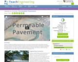
Students investigate how different riparian ground covers, such as grass or pavement, affect river flooding. They learn about permeable and impermeable materials through the measurement how much water is absorbed by several different household materials in a model river. Students use what they learn to make recommendations for engineers developing permeable pavement. Also, they consider several different limitations for design in the context of a small community.
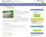
The lesson introduces students to the steps of the water cycle and rivers. They think about the effects of communities, sidewalks and roads on the natural flow of rainwater. Students also learn about the role of engineering in community planning and protecting our natural resources.

Students build on their understanding and feel for flow rates, as gained from the associated Faucet Flow Rate activity, to estimate the flow rate of a local river. The objective is to be able to relate laboratory experiment results to the environment. They use the U.S. Geological Survey website (http://waterdata.usgs.gov/nwis/rt) to determine the actual flow rate data for their river, and compare their estimates to the actual flow rate. For this activity to be successful, choose a nearby river and take a field trip or show a video so students gain a visual feel for the flow of the nearby river.

Students learn how water is used to generate electricity. They investigate water's potential-to-kinetic energy transformation in hands-on activities about falling water and waterwheels. During the activities, they take measurements, calculate averages and graph results. Students also learn the history of the waterwheel and how engineers use water turbines in hydroelectric power plants today. They discover the advantages and disadvantages of hydroelectric power. In a literacy activity, students learn and write about an innovative new hydro-electrical power generation technology.

Learn bow the Grand River plated a role in the economy and culture of the people who lived along the river. [3:59]

An in-depth description of Pygmy Hippopotamus, including their classification, appearance, habitat, adaptations, reproduction, diet, and other interesting facts. Also includes pictures and video.

In this lesson, students learn about major landforms (e.g., mountains, rivers, plains, valleys, canyons and plateaus) and how they occur on the Earth's surface. They learn about the civil and geotechnical engineering applications of geology and landforms, including the design of transportation systems, mining, mapping and measuring natural hazards.
Students read informational texts about the seven continents, and what makes each of them unique, while working to understand text features and develop skills in writing about informational texts.

Students learn about contamination and pollution, specifically in reference to soil in and around rivers. To start, groups use light sensors to take light reflection measurements of different colors of sand (dyed with various amounts of a liquid food dye), generating a set of "soil" calibration data. Then, they use a stream table with a simulated a river that has a scattering of "contaminated wells" represented by locations of unknown amounts of dye. They make visual observations and use light sensors again to take reflection measurements and refer to their earlier calibration data to determine the level of "contamination" (color dye) in each well. Acting as engineers, they determine if their measured data is comparable to visual observations. The small-scale simulated flowing river shows how contamination can spread.

Students are introduced to the basic biology behind Pacific salmon migration and the many engineered Columbia River dam structures that aid in their passage through the river's hydroelectric dams. Students apply what they learn about the salmon life cycle as they think of devices and modifications that might be implemented at dams to aid in the natural cycle of fish migration, and as they make (hypothetical) Splash Engineering presentations about their proposed fish mitigation solutions for Birdseye River's dam in Thirsty County.

The U.S. Geological Survey reports on the latest news affecting the earth today, as well as providing a wealth of data, reports, and information.

Students learn about floods, discovering that different types of floods occur from different water sources, but primarily from heavy rainfall. While floods occur naturally and have benefits such as creating fertile farmland, students learn that with the increase in human population in flood-prone areas, floods are become increasingly problematic. Both natural and manmade factors contribute to floods. Students learn what makes floods dangerous and what engineers design to predict, control and survive floods.

Students learn about the water cycle and its key components. First, they learn about the concept of a watershed and why it is important in the context of engineering hydrology. Then they learn how we can use the theory of conservation of mass to estimate the amount of water that enters a watershed (precipitation, groundwater flowing in) and exits a watershed (evaporation, runoff, groundwater out). Finally, students learn about runoff and how we visualize runoff in the form of hydrographs.

Students perform a macroinvertebrate survey to gauge the health of a local river. They collect water samples and count macroinvertebrates to learn how the health of a river's ecosystem can be determined by its river insect population.